warning
This auction is archived, you cannot bid or buy items from this auction!
1832 JOSEFOV fortress plan Josefov, format 128x115cm, underglued, slightly damaged, after all, very interesting U:X
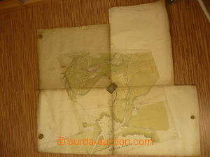
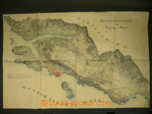
1840 DUBROVNIK (Ragusa), by hand drawn and colored map, format 93x61cm, underglued by fabric, folded into format A3, good condition U:A3s|
1850? RODOV village plan Rodov (dist. Hradec Králové), 5 sheets format 65x65cm, good condition U:X
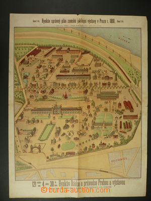
1891 PRAGUE Jubilee land exhibition in Prague, Hynkův right plan, format 46x80cm, issued Hynek, folds, tearing in margin U:A3s|
1900 MĚLNÍK port Mělník, plan 1:2880, format 140x67cm, folded into format A4, good condition, very interesting U:O4
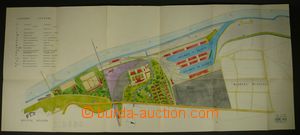
1901 MĚLNÍK port Mělník, plan 1:1000, format 91x97cm, folded into format A4, good condition, very interesting, also with plan - port Mělník from y 1944, scale 1:2880 U:O4
1904 HRADEC KRÁLOVÉ village plan Pražské Předměstí, format 80x60cm, good condition U:X
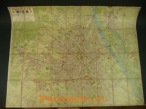
1910? Wien, wall map, scale 1:17000, format 98x77cm, underglued by fabric, folded into pocket size U:O5
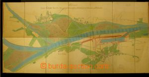
1913 MĚLNÍK port Mělník, plan 1:1000, format 243x108cm, folded into format 45x45cm, good condition, very interesting U:X
1922 VÍTKOVICE - iron-works, panorama, format 64x22cm, light damaged margins U:X
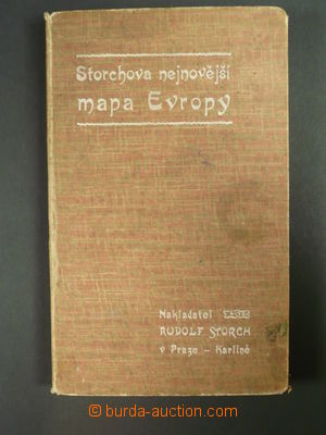
1909 Storchova map Europe, scale 1:7.000.000, format 92x75cm, underglued by fabric, folded into pocket size, in hard cover, good condition U:O5
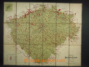
1910 cyclist map of Kingdom of Bohemia, scale 1:500.000, format 71x57cm, underglued by fabric, folded into format A5, good condition U:O5
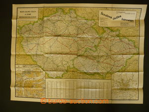
1929 Škodova wall map of Bohemia, Moravia and Silesia, format 92x68cm, folded, good condition U:O4
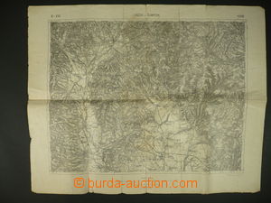
1925 Czechoslovakia military section maps, comp. 13 pcs of maps (3 damaged), scale 1:75.000, contains regions Jičín, Vrchlabí, Náchod, Žamberk, Rychnov n./K., Jeseník, Fryštát, Boskovice, Uherský Brod and Vizovice U:O4
1930-60 EAST BOHEMIA comp. 10 pcs of maps, folded into format A4, good condition, placed in box U:K
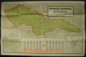
1935 comp. 2 pcs of wall maps, map Czechoslovakia from y 1935, 1:1.000.000, calendar + advertising Frýdecká bank, also with Fastr's road map, 1:300.000, sheet 2 - eastern Bohemia; tearing in margins U:O4
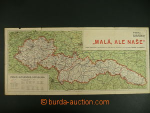
1938 map Czechoslovak republic after occupation of Sudetenland, with advertising added print Kolin Chicory - "Small but our", size 57x26cm; folds and tearing in margins U:A3s|
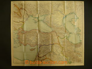
1941-43 comp. 3 pcs of wall maps, 1) Middle East and South Caucasus, 1:3.000.000; 2) eastern Europe - Russia, Baltic states, Finland, 1:3.000.000; 3) south Europe - Greece, Bulgaria, 1:1.500.000; issued Perthes, Gotha, all very good condition U:O4
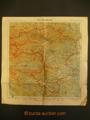
1943 wall map Alpen- and Donau Reichsgaue, scale 1:500.000, format 120x90cm, north border with BOHEMIA-MORAVIA, very good condition, also with 2 smaller map/-s Carinthia and Styria; interesting U:O4
1878 HYDROLOGY plan toku Vltava, Podbaba, scale 1:2880, format 66x42cm, folded into format A4, good condition U:O4
1880-1940 HYDROLOGY selection of 24 pcs of plans and maps, drainage basin river/-s Elbe, regulation and oths., supplemented with textovou dekumentací, good condition, very interesting U:Z
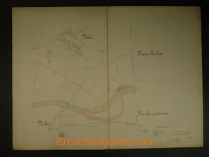
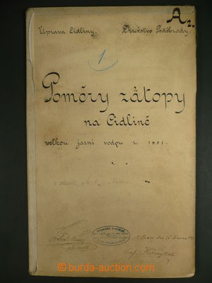
1891 HYDROLOGY drainage basin river/-s Cidliny - povodňový plan, format 63x45cm, folded into format A4 U:O4
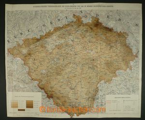
1897 HYDROLOGY map srážkových úhrnů in Bohemia, scale 1:750.000, format 50x42cm, folded into format A4, short tear in margin U:O4
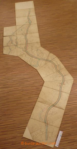
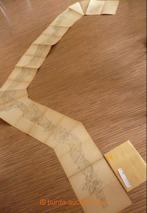
1900 HYDROLOGY drainage basin map Elbe within the field Vysoká–Opatovice, 13 sides A4, good condition U:O4
1900? HYDROLOGY drainage basin map Elbe within the field Josefov–Velký Osek, 21 sides A4, good condition U:O4
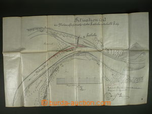
1906 HYDROLOGY regulation Elbe, HOSTINNÉ (Arnau), selection of plans with description, scale 1:1000, in original cover, extraordinary U:K
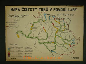
1946 HYDROLOGY map čistoty vod in/at drainage basin řek Elbe, Danube and Odry, scale 1:750.000, format 75x50cm, folded into format A4, also with map A4 - drainage basin Elbe U:O4
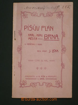
1900 Píšův plan royal main town Brno, paperback with inserted plan town 1:10.000, uvedený listing square and streets, public buildings, offices, institutions etc.., lot of advertisings, good condition U:O5
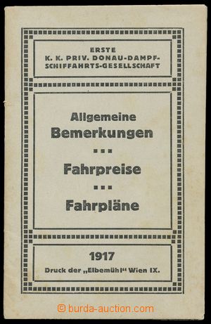
1917 Danube Steamship Travel Co., General remarks, rates, timetables, pocket manual in German, 48 sides, good condition U:A5
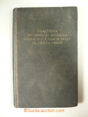
1926 TRANSPORT Šoun: Praktická informative manual, listing streets and electric railway main town Prague, issued by Trade Union, Prague, pocket format, good condition U:O5
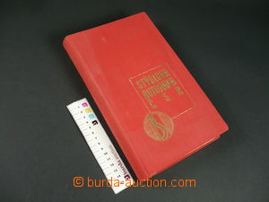
1930 Stýblův auto-atlas Č.S.R., 32 sheets, scale 1:300.000, incl. Pokarpatské Russia, trojjazyčné issue (Czech language, French, German), processed Keitner, issued B. Stýblo, Prague, 31 průjezdních maps towns, advertising, transport marks, tables vzdáleností etc.. very good condition U:O4
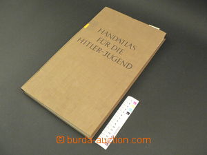
1939 Handatlas für die Hitler-Jugend, Volk and Reich Verlag Ltd., Berlin, 60 mapových sheets, 102 sides rejstříku, in good condition U:Z