warning
This auction is archived, you cannot bid or buy items from this auction!
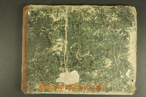
1848 ATLAS Adolf Stieler: Schul-Atlas Over Alle Theile Der Erde Und Over Das Weltgebäude, issued Justus Perthes, Gotha, 20 colored maps, copper engraving, damaged folder, with signs of usage, viewing of quality recommended U:O4
1848 ATLAS Adolf Stieler: Schul-Atlas Over Alle Theile Der Erde Und Over Das Weltgebäude, issued Justus Perthes, Gotha, 32 colored maps, copper engraving, damaged folder, some sheets loose and dirty, viewing of quality recommended U:O4
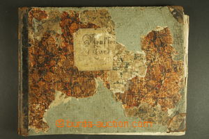
1869 ATLAS B. Kozenn: Geographischer Atlas für die Schulen der österr. ungar. Monarchy, issued Hölzel, Wien and Olomouc, 10 maps, have/has signs of usage, viewing of quality recommended U:O4
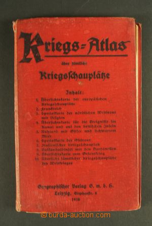
1916 ATLAS Kriegs-Atlas über sämtliche Kriegsschauplätze, Geographischer Verlag, Leipzig, 10 maps, folded into pocket size; damaged backbone U:O5
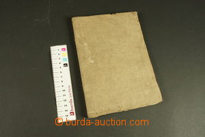
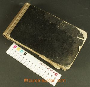
1850 ATLAS Meyer's Pfennig-Atlas, school atlas, 108 maps, siderography, pocket format 11,5x18,5cm, with signs of usage U:O5
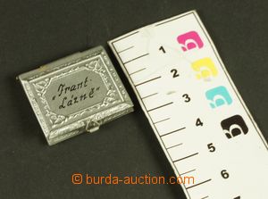
1910 MINIATURE BOOK / FRANTIŠKOVY LÁZNĚ (Franzensbad) - folding picture-book in/at Al cover 31x28mm U:A5
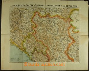
1910-14 BOSNIA AND HERZEGOVINA, SERBIA, MONTENEGRO comp. 3 pcs of maps format 50x50cm, Bosnia and Herzegovina, Serbia and north Serbia and Montenegro, scale 1:750.000 and 1:1.250.000; underglued by fabric, good condition U:O4
1925 CEYLON The hundred best views of Ceylon, 100 paintings from Cejlonu, frayed margins, else preserved U:O4
1940 BOHEMIA-MORAVIA Komůrkova road map, sheet 11 - Jihlava, good condition U:O5
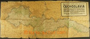
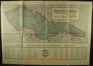
1938 CZECHOSLOVAKIA 1918-39 wall map Czechoslovak republic after occupation of Sudetenland, scale 1:1.000.000, size 90x37cm, frayed margin U:O4
1928 CZECHOSLOVAKIA 1918-39 wall map, scale 1:1.000.000, size 90x67cm, frayed margin, very good condition U:A3s|
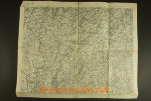
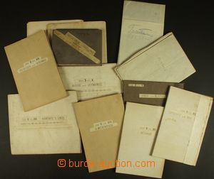
1914-29 CZECHOSLOVAKIA 1918-39 selection of 26 pcs of special maps 1:75.000, Harrachov and Jelenia Góra, Vrchlabí, Česká Lípa, Turnov, Mělník, Jičín, Josefov and Náchod, Hradec Králové, Rychnov n/K., Těšín, Frýdek and Jablunkov, Hranice, Olomouc, Pelhřimov, Jihlava, Sušice and Vimperk, Jindřichův Hradec, Dačice and Moravské Budějovice , Brno, Český Krumlov, České Budějovice, Slavonice and Drosendorf, Znojmo, Hodonín and Břeclav, Kaplice and Freistadt, Horn; standard quality U:O4
1915-25 CZECHOSLOVAKIA 1918-39 comp. 7 pcs of maps 1:200.000, format 62x45cm, folded into format A5, Jihlava, Brno, Břeclav, Olomouc, Opava, Prague - underglued by fabric, Bratislava, Košice; standard quality U:O4
1938 CZECHOSLOVAKIA 1918-39 road map with marking status vozovek, scale 1:750.000, format 83x63cm, advertising, very fine U:A3s|
1925? CZECHOSLOVAKIA 1918-39 special map - Slavonice and Drosendorf, Dačice and Moravské Budějovice , Jindřichův Hradec, 1:75.000, format 85x68cm, underglued by fabric, format 100x76cm, good condition, folded into pocket size U:O5
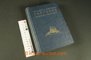
1933 CZECHOSLOVAKIA 1918-39 Stehlík, Žáček: Stehlíkův historical and orientační guide ulicemi main town Prague, issued Stehlík, Prague, 624 page., very good condition U:Z
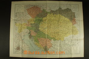
1907 AUSTRIA-HUNGARY the first Reichsrats-Wahlkarte, map electoral výsledků, contains listing poslanců from single electoral regions, good condition, interesting U:O5
1900 AUSTRIA-HUNGARY Reichstagsgebäude in Wien, map in hard cover, pocket format U:A5
1911-13 AUSTRIA-HUNGARY comp. 6 pcs of special maps 1:75.000, Jindřichův Hradec - worse condition, Dačice and Moravské Budějovice , Třebíč and Moravský Krumlov, Litschau and Gmünd, Drosendorf, Znojmo; standard quality U:O4
1900 AUSTRIA-HUNGARY topografická map, scale 1:2.000.000, format 76x58cm, folded into format A5, good condition U:O5
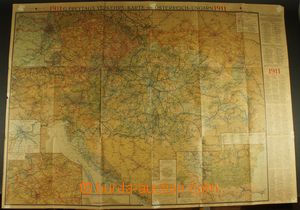
1911 AUSTRIA-HUNGARY railway map Freytag-Berndt, scale 1:1.500.000, format 99x71cm; partially torn in margins U:O4
1882-1914 AUSTRIA-HUNGARY (BOHEMIA, MORAVIA) comp. 13 pcs of special maps 1:75.000, Ústí n./L. and Litoměřice, Liberec and Frýdlant, Trutnov and Police n./M., Žamberk, Písek and Blatná, Kamenice above Lípou, Velké Meziříčí , Jindřichův Hradec, Dačice and Moravské Budějovice , Třebíč and Moravský Krumlov, České Budějovice and Nové Hrady , Vizovice and Beluša, Hranice; part underglued by fabric, standard quality U:O5
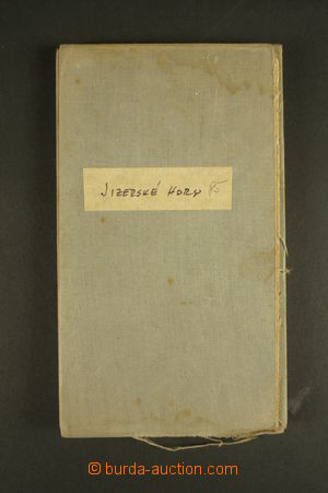
1910 AUSTRIA-HUNGARY (BOHEMIA) tourist map - Ještěd and Jizera Mountains, issued Sollors, Reichenberg, 1:80.000, format 85x68cm, underglued by fabric, good condition U:O5
1868 AUSTRIA-HUNGARY (MORAVIA) folding map, Alois Vojtěch Šembera: Map of Moravia, with parts border Silesia, Čech/Bohem, Austria and Hungary, scale 1:288.000, format 105x82cm, folded into format A5, underglued by fabric, superb condition! U:O5
1915-35 SLOVAKIA, CARPATHIAN RUTHENIA comp. 7 pcs of special maps 1:75.000, Ružomberok, Senica and Piešťany, Košice, Rožňava, Trnava, Chop, Khust; standard quality U:O4
1930-87 CZECHOSLOVAKIA selection of automap Czechoslovakia in/at one box, contains i.a. several numbers Austrian automap Autokarte der Tschechoslowakischen Republic, brožuru with listing hotels in Czechoslovakia from year 1937, advertising lepolero hotel Olympic Palace in Karlsbad, comp. 13 pcs of administrativních maps Czechoslovakia from year 1987 etc.., supplemented with several maps Austria and turistickými průvodci; good condition U:K