warning
This auction is archived, you cannot bid or buy items from this auction!
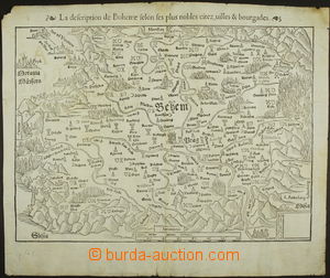
1570? MAPA KRÁLOVSTVÍ ČESKÉHO according to Sebastiana Münstera (1488-1522), French text, size 35x25cm; slightly toned and small tearing in margins, otherwise in good condition condition, interesting U:A3s|
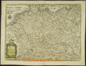
1646 MAPA SV. EMPIRE NÁRODA NĚMECKÉHO and complete Central Europe incl. Bohemian kingdom, March of Moravia etc.., legenda Nova Totius Germaniae, Merian, copperplate 35x27cm; very sound condition U:A3s|
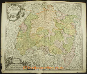
1700 MAPA ŠVÝCARSKA colored map Švýcarských kantonů, with veduta, legenda in Latin, Johann Homann (1664-1724), gravure, size 55x50cm; in margins small tearing, otherwise in good condition condition, interesting U:X
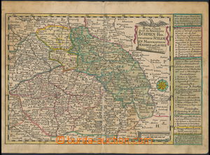
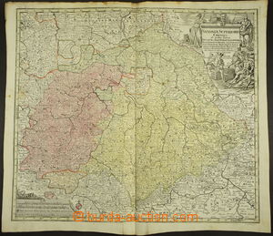
1720-40 MAPA ČESKÉHO KRÁLOVSTVÍ, MARKRABSTVÍ MORAVSKÉHO A KNÍŽECTVÍ SLEZSKÉHO colored map smaller format 27x18cm, legenda German, author Johann George Schreiber (1676-1750); toned, otherwise in good condition condition, interesting U:A4
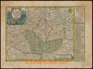
1720-40 MAPA MARKRABSTVÍ MORAVSKÉHO colored map March of Moravia, Opavského knížectví, Opolského knížectví etc.., smaller format 27x18cm, legenda German, author Johann George Schreiber (1676-1750); toned, otherwise in good condition condition, interesting U:A4
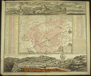
1730-40 MAPA CHEBSKA colored map Chebska with veduta Karlovy Vary, castle Loket, incl. legends, author Georg Matthäus Seutter (1678-1757), legenda German, size 61x52cm, very sound condition, interesting U:X
1730-50 MAPA SASKA (Sachsen (Saxonia)) colored map Saxony with part of territory of Kingdom of Bohemia, with veduta, legenda in Latin, author Georg Matthäus Seutter (1678-1757), size 56x50cm; in good condition condition U:X
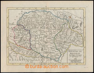
1750 MAPA UHERSKÉHO KRÁLOVSTVÍ incl. Horních Hungary (Slovakia), legenda Royaume de Hongrie, Didier Robert de Vaugondy (slavný kartograf King Lewis XV.), copperplate 22x16,5cm; very sound condition U:A4
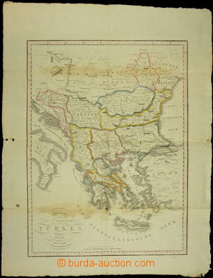
1890 MAPA BALKÁNU "Karte von Der Europäischen Türkey", Wien bey T.Mollo, size 40x53cm, folded U:A3s|